

Red River NM Hiking Trails: 7 Trails From Town Walks to Wheeler Peak
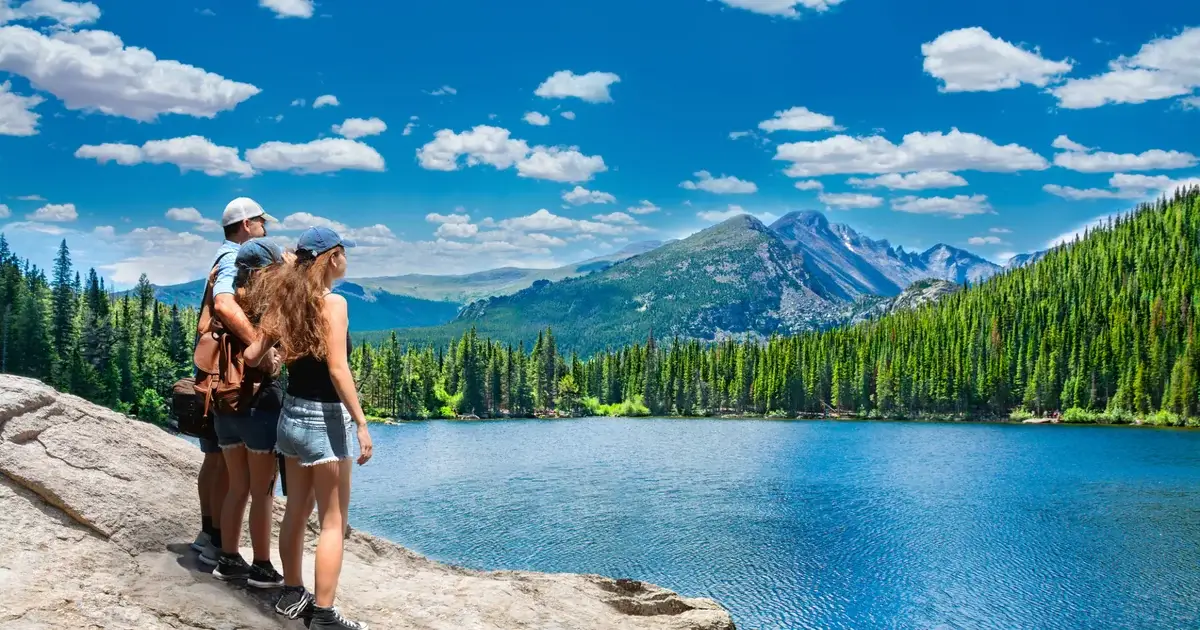
Red River NM hiking trails range from a quarter-mile town walk to the highest summit in New Mexico. Is Red River good for hiking? Yes. It is one of the more underrated hiking destinations in northern New Mexico, and Carson National Forest wraps the town on three sides. The harder question is which trail to pick.
Your right hike depends on your group, your vehicle, your weather window, and your altitude tolerance. This guide covers seven trails worth doing, plus a decision table to match the hike to your situation, and the local details (the 1pm rule, mud season timing, current fire restrictions) that change which trails make sense in any given week. The list starts with easy in-town walks, then moves into moderate forest hikes and serious alpine routes for prepared hikers. For the broader things to do in Red River, hiking is one piece of the summer mix.
The best Red River NM hiking trails range from quarter-mile town walks to a 13,161-foot summit. Easy walks (in town): Mallette Park Nature Trail and Red River Nature Trail. Moderate day hikes: Columbine Canyon Trail and Middle Fork Lake. Hard: Lost Lake Trail and Goose Creek to Goose Lake. Strenuous: Wheeler Peak via Williams Lake, the highest summit in New Mexico. Hiking season runs late June through early October.
- Red River sits at 8,750 feet, with cool temperatures and quick-changing mountain weather
- Two trails (Red River Nature Trail and Mallette Park) are walkable from Main Street
- Five trails require a short drive to Carson National Forest trailheads
- Wheeler Peak at 13,161 feet is the highest point in New Mexico, accessed most easily via Williams Lake
- Best hiking season runs late June through early October once snow clears
- Stage 1 fire restrictions on Carson National Forest are in effect as of April 2026
Top Trails at a Glance
- Red River Nature Trail. Easy, 3 miles, riverside, walkable from Main Street.
- Mallette Park Nature Trail. Very easy, quarter-mile loop with a small cave, walkable from Main Street.
- Columbine Canyon Trail #71. Moderate, up to 7.4 miles, creek crossings and aspen.
- Middle Fork Lake Trail. Moderate, 4 miles, alpine lake at 10,840 feet.
- Lost Lake Trail #91. Hard, 10.4 miles, alpine lake at 11,495 feet.
- Goose Creek Trail #65. Hard, 11.5 miles, alpine lake with creek crossings at high elevation.
- Wheeler Peak via Williams Lake. Strenuous, 8.3 miles, the summit of New Mexico.
Choose Your Red River NM Hiking Trail
The right Red River hike depends less on which trail is "best" and more on what your group, vehicle, and day allow for. Match the row to your situation and start there.
| If you have/are… | Pick this trail | Why |
|---|---|---|
| First day at altitude | Red River Nature Trail | Easy acclimation, no drive needed |
| Kids or grandparents in tow | Mallette Park Nature Trail | Quarter-mile loop with a playground |
| A standard car (no high clearance) | Columbine Canyon | Accessible trailhead, classic Carson NF feel |
| Half a day and want a real hike | Middle Fork Lake | Alpine lake payoff in 4 miles |
| High-clearance or 4WD vehicle | Lost Lake Trail | Backcountry payoff, rougher approach |
| A long day, no summit ambition | Goose Creek to Goose Lake | 11.5-mile alpine lake without summit exposure |
| A full day and the summit goal | Wheeler Peak via Williams Lake | Highest point in New Mexico |
| Clouds building before noon | Stay in town | Nature Trail keeps you safer than any drive-to trailhead |
What Do Guests Ask About Red River Hiking?
Three questions come up more than any others when guests check in or call the front desk. The answers come from those conversations, not from a brochure.
"We only have one morning. What can we actually do?"
Use the Decision Table above. The Red River Nature Trail starts a five-minute walk from Lifts West and gives you 3 miles of river views before a late lunch. If a quarter-mile loop is more your speed, the Mallette Park Nature Trail is even closer.
"Can our kids handle the trails near town?"
Yes for the easy ones. Mallette Park and the lower section of the Red River Nature Trail both stay near water and are stroller-friendly. Anything marked Moderate or above in the comparison table is built for adult legs and adult attention spans.
"When should we turn around if a storm starts building?"
Use the 1pm Rule. If you are above tree line and clouds stack up before noon, start down. Do not try to summit. The summer pattern is sun in the morning and lightning by 2 or 3pm, and the first sound of thunder is your turn-around signal.
Before You Hit the Trail
Four things matter most at 8,750 feet, and getting any of them wrong can ruin a hike or worse.
Be off exposed ridgelines by early afternoon during July and August.
Afternoon thunderstorms build fast in July and August. The mountain monsoon pattern means sun in the morning and lightning by 2 or 3pm. Above tree line, you are the tallest thing on the mountain, and lightning is a serious personal safety risk. National Park Service guidance treats exposed terrain in afternoon storms as the highest-risk environment for hikers and recommends seeking shelter at the first sound of thunder.
For any hike that goes above tree line, start before sunrise. That applies to Wheeler Peak, Lost Lake, Goose Creek, and the upper sections of Columbine. Aim to be off exposed ridgelines by 1pm. For lower-elevation trails like the Red River Nature Trail, mid-day storms still happen, but the consequences are less severe.
Altitude affects everyone. Even fit visitors from sea level feel the elevation here. Drink more water than you think you need. Use your first day in town for an easy walk before taking on a moderate trail. If you are driving in from Texas or Oklahoma, your acclimation starts the moment you arrive.
Strong UV at altitude. UV radiation rises about 2% per 1,000 feet of elevation. At Red River's altitude, that runs roughly 14% above sea-level UV, and closer to 26% near the Wheeler Peak summit, per Carson National Forest. Sunscreen, hat, and sunglasses on every hike. Cool and cloudy days still cause sun damage at this elevation.
Layers and a rain shell. Mornings on the trail can sit in the 40s even in July. Afternoon temperatures swing 25 or 30 degrees. A light rain shell handles the surprise storms that roll through. Cell service is unreliable above town, so download trail maps before you go.
Trail access, fire restrictions, road conditions, snowpack, creek crossings, and annual cultural closures can change. Before longer hikes, check Carson National Forest alerts and the local forecast.
Red River NM Hiking Trails Compared
Quick reference for distance, gain, and trailhead access. Detailed write-ups below.
| Trail | Distance | Elev. Gain | Difficulty | Trailhead Access |
|---|---|---|---|---|
| Red River Nature Trail | 3.0 mi | 446 ft | Easy | Walkable from Main St |
| Mallette Park Nature Trail | 0.25 mi loop | minimal | Very Easy | Walkable from Main St |
| Columbine Canyon #71 | up to 7.4 mi | 1,578 ft | Moderate | 8 mi west on NM-38 |
| Middle Fork Lake | ~4 mi | 1,240 ft | Moderate | End of NM-578, FR 58 |
| Lost Lake #91 | 10.4 mi | 2,060 ft | Hard | Middle Fork road (4WD) |
| Goose Creek #65 | 11.5 mi | 2,818 ft | Hard | 2.5 mi up NM-578 |
| Wheeler Peak (Williams Lake) | 8.3 mi | 2,972 ft | Strenuous | Taos Ski Valley |
Trail-by-Trail Guide: Hiking Trails Near Red River
1. Red River Nature Trail
The Red River Nature Trail is the trail most visitors do first, for good reason. The trailhead sits at the Red River Visitor Center, a short walk down Main Street from Lifts West. Park if you drive, or stretch your legs on the way over. The path follows the river at the base of the mountain, with shade through pine and aspen and quiet sections that hide the noise of town. Interpretive signs along the way cover local geology, plants, and wildlife.
The full out-and-back covers 3 miles with 446 feet of gain. It is comfortable for most fitness levels and a solid acclimation hike on day one. AllTrails reviewers note the signage gets thin near the ski lift crossover and a section in the middle can feel narrow on gravel. Download a map before you go and bring sturdy shoes. Dogs are welcome on leash. Plan to encounter joggers and dog walkers in the morning; the trail thins out by mid-day.
2. Mallette Park Nature Trail
A short walk from Lifts West down Mallette Road brings you to Mallette Park, where a quarter-mile loop trail starts to the left of the tennis courts. The loop crosses a small bridge, follows Mallette Creek through fir trees, and passes a small cave you can step into. It is the right hike for grandparents, kids, or a stretch break before lunch. The park itself includes a playground, disc golf in summer, and picnic spots along the creek.
This is a town park trail, so no permits or fees apply. Guests often pair the loop with time at the playground for a quick afternoon outing when nobody wants to commit to a real hike.
3. Columbine Canyon Trail #71
Columbine Canyon Trail #71 starts at the back of Columbine Campground, about 8 miles west of Red River on NM-38, between Red River and Questa. The trail follows Columbine Creek through aspen groves and open meadows into the Columbine-Hondo Wilderness. Footbridges cross the creek at the first four crossings. Beyond those, expect to wade if you push deeper.
Most hikers turn around at the first big meadow and call it a day. You do not need to push to the ridge to feel like you saw it. The full route to a popular meadow turnaround is about 3.7 miles in (7.4-mile round trip with around 1,578 feet of gain). Beyond that, the trail steepens through old-growth forest toward Lobo Ridge and connects to Lobo Peak and Gold Hill for ambitious day hikers. Bicycles are not permitted on the wilderness portion. Parking and campground/day-use fees may vary, so check current Carson National Forest information before you go.
4. Middle Fork Lake Trail
The Middle Fork Lake Trail is the highest payoff for the shortest mileage near Red River. Drive about 6 miles up NM-578 to where the road ends, then a mile up Forest Road 58. Parking at the trailhead can fill by 9am on summer weekends; arrive earlier or plan a weekday hike.
The trail follows Middle Fork Creek through dense forest, with waterfalls along the way and a creek crossing where you will likely get wet feet. After the crossing, a series of switchbacks climbs to the lake at 10,840 feet. Round trip is about 4 miles with 1,240 feet of gain. Allow 2.5 to 4 hours on the trail. Trout fishing is popular at the lake (a New Mexico fishing license is required). Dogs welcome on leash.
5. Lost Lake Trail #91
Lost Lake is the most popular hard hike in the area, with a 4.7-star rating across more than 300 AllTrails reviews. The trail begins on the Middle Fork jeep road in the Upper Red River Valley. The approach road gets rough enough that guests in low-clearance cars often turn back before the trailhead; high-clearance or 4WD is strongly recommended.
From the trailhead, the route switchbacks through Douglas-fir and white fir up to a ridge at about 2 miles, then opens into meadows and crosses into the Wheeler Peak Wilderness about half a mile from the lake. The lake sits at 11,495 feet and holds native cutthroat trout (a New Mexico fishing license is required). Round trip is 10.4 miles with 2,060 feet of gain. Plan 5.5 to 6 hours. Campfires are not permitted at the lake. Camping is allowed but must be at least 300 feet from the shore. Note: A short section of Trail #91 near Wheeler Peak closes for one week annually for traditional cultural purposes; the lake itself remains accessible. Start early.
6. Goose Creek Trail #65
Goose Creek Trail #65 is the closer-trailhead alternative to Lost Lake when you want a serious alpine lake day without the rough approach road. The trailhead sits about 2.5 miles up NM-578 from Red River on the west side of the road, a 5 to 7 minute drive from Lifts West. Do not let the close trailhead fool you. Goose Creek is a long, high-elevation hike with nearly 3,000 feet of gain. The trail climbs through aspen groves and open meadows before reaching Goose Lake at roughly 11,610 feet.
Round trip is about 11.5 miles with 2,818 feet of gain, and most hikers take 6.5 to 7 hours. The trail crosses creek sections that can be tricky in early season; some AllTrails reviewers recommend snow shoes through June. This is backcountry habitat, so make noise on switchbacks, keep food secured, and follow posted wildlife guidance. Goose Lake holds trout (a New Mexico fishing license is required), and there is an outhouse at the lake. Dogs are welcome on leash. Goose Lake is also accessible by ATV or 4WD via Forest Road 486 if you want the lake without the climb. Most guests who do this hike report the descent feels significantly easier than the climb up.
Wheeler Peak: The Summit of New Mexico
Wheeler Peak is the highest point in New Mexico at 13,161 feet. It is not a casual day hike. Done right, it is a memorable summit. Done wrong, it is dangerous. Plan a day or two in town before attempting it; the altitude makes a real difference. If you are considering Wheeler, read this whole section before committing.
Two Main Routes From the Red River Area
The Williams Lake route is the popular and shorter approach, starting from the Taos Ski Valley parking lot, a 45 to 60 minute drive from Red River over Bobcat Pass. Round trip is 8.3 miles with 2,972 feet of gain. Most hikers take 6 to 8 hours. The trail passes the Williams Lake junction at about 2 miles, then climbs steeply through forest, switchbacks above tree line, and crosses a long scree field to the summit. AllTrails has more than 4,500 reviews on this route at 4.8 stars.
The East Fork Red River route is the longer Red River-side option, 16.6 miles round trip with 3,572 feet of gain. Plan 8.5 to 9.5 hours. It is quieter, more scenic, and a real backcountry day. Better suited to experienced hikers.
- Hiking season runs late June to early October. Snow can persist into early summer and return by mid-October.
- Start before sunrise. The summit is fully exposed. Lightning is a serious risk after early afternoon in July and August.
- Altitude affects everyone above 12,000 feet. Drink water aggressively, eat regularly, and slow your pace as you climb.
- Wind at the summit regularly hits 50 mph or more. Bring a wind layer, even on warm days.
- The final scree field is loose underfoot. Trekking poles help.
- Cell service is unreliable. Tell someone your plan and expected return time.
- No permit is required for day hiking. Dogs are allowed on leash.
- Williams Lake (#62), Wheeler Summit (#67), and Wheeler Peak (#90) trail sections close for one week annually for traditional cultural purposes. Check current alerts before your trip.
If you are not used to high elevation, plan an acclimation day on the Red River Nature Trail or Middle Fork Lake first. Wheeler punishes anyone who skips this step.
Lifts West sits in the heart of Main Street, walking distance to two trailheads and a short drive to the rest. Check dates at Lifts West →
Hiking Season by Month
Trail conditions change quickly through the summer. Snow lingers into early June at higher elevations, dries out by mid-summer, and returns by mid-October. Here is what to expect for hiking in Red River, New Mexico through the season.
| Month | Conditions | Best For |
|---|---|---|
| June | Snow patches above 11,000 ft; some trails muddy until mid-month | Lower-elevation trails, wildflowers |
| July | Full trail access; afternoon storms common | Most moderate hikes; very early summit attempts |
| August | Stable trails; storm pattern continues into mid-month | Wheeler Peak, alpine lakes |
| September | Cooling temperatures; aspens turning by late month | Goose Creek, Lost Lake; quieter than peak summer |
June
June is the quietest hiking month in Red River. Lower-elevation trails dry out first. Snow may linger on north-facing slopes above 11,000 feet through mid-month. Forest Service roads can be muddy or rutted from snowmelt early in the month; locals call it "mud season," and it can affect access to higher trailheads like Middle Fork Lake and Lost Lake. Wildflowers peak through late June. Stick to the Nature Trail, Mallette Park, and Columbine Canyon early in the month. Higher-elevation trails are usually fully accessible by the third week.
July and August
The heart of hiking season runs through July and August, with daytime highs of 70 to 80°F and overnight lows in the 40s. Afternoon thunderstorms are the rule, not the exception. The 1pm rule applies on every above-treeline hike: be off exposed ridges by early afternoon. Crowds thicken on weekends, especially around the 4th of July and the 8750′ Festival in mid-August. Plan summit attempts and longer hikes for weekdays if you can. Trail conditions are at their best.
September
September is one of the best hiking months in Red River. Storms taper off, days stay warm, and aspens start turning gold by mid-month. Trail crowds thin after Labor Day. Watch for early-season cold fronts that can drop snow at higher elevations. By late September, Wheeler Peak conditions become unpredictable. Lower trails stay open well into October.
Where Should You Stay for Red River Hiking?
Staying on Main Street in Red River means walking to two of the seven trails in this guide and a short drive to the rest. Lifts West Condominiums sits at 201 W Main Street in Taos County, on the Enchanted Circle Scenic Byway, a short walk from the Red River Nature Trail and Mallette Park trailheads. Carson National Forest trailheads sit 5 to 25 minutes from Lifts West, with Goose Creek the closest at about 5 to 7 minutes up NM-578. Wheeler Peak via Williams Lake is a scenic 45 to 60 minute drive over Bobcat Pass.
Units have full kitchens, which helps when you are back from a long hike and do not feel like a restaurant. The heated pool helps after a hard trail day. The on-site café gives you a quick breakfast option without a Main Street walk. Call 575-754-2778 to ask about availability or trail recommendations from the front desk.
For the broader Red River summer experience, see our things to do in Red River NM in summer guide. For seasonal timing details, check our June, July, August comparison. If you want to break up your hiking days with off-road driving, ATV rentals in Red River NM get you onto Forest Roads that drive-in hikers usually skip. The full Red River event calendar lines up music festivals and Main Street events with your trip dates.
Wet Weather Backup
Storms blow through Red River fast. If clouds build while you are on the trail above tree line, descend immediately to lower elevation. Lightning is a real risk at altitude.
Once safely off the mountain:
- Head back to your room. Cook, dry off, reset for the evening.
- The Red River Community House runs free indoor programs most afternoons in summer.
- Main Street galleries and shops are easy walks for a wet afternoon.
- T-Bucks Burgers, Bull o' the Woods Saloon, and Shotgun Willie's BBQ all do early dinners that work after a wet hike.
Storms usually clear by early evening. If you have shifted your hike to morning, you have plenty of afternoon options.
By this point your decision should be clearer. The only question left is when you can get on the trail.
Red River NM Hiking Trails: Common Questions
When is hiking season in Red River NM?
Hiking season runs late June through early October. Lower-elevation trails like the Red River Nature Trail open earlier and stay open longer. Higher routes like Wheeler Peak, Lost Lake, Goose Creek, and Middle Fork Lake clear of snow by late June and start to refreeze by mid-October. Best months for stable conditions are mid-July through late September.
What is the easiest hike in Red River NM for families?
The Mallette Park Nature Trail is the easiest hike in town. The quarter-mile loop is suitable for kids, grandparents, and anyone who wants a scenic walk without elevation gain. The trail starts to the left of the tennis courts at Mallette Park, just off Mallette Road. The Red River Nature Trail is a longer easy option at 3 miles round trip with 446 feet of gain.
How long does it take to hike Wheeler Peak?
The Williams Lake route to Wheeler Peak is 8.3 miles round trip and takes most hikers 6 to 8 hours, with 2,972 feet of elevation gain. The East Fork Red River route is longer at 16.6 miles and typically takes 8.5 to 9.5 hours. Start before sunrise to avoid afternoon thunderstorms above tree line.
Do you need a permit to hike Carson National Forest near Red River?
Day hiking on established Carson National Forest trails near Red River does not require a special permit. Some trailheads at developed campgrounds may charge a day-use parking fee, and these can change. As of spring 2026, Stage 1 fire restrictions are in effect on Carson National Forest, which prohibits campfires outside permanent fire rings at developed sites and limits other ignition sources. Conditions, closures, and fire restrictions can change. Call the Questa Ranger District at 575-586-0520 for the most current information before you go.
Are dogs allowed on Red River hiking trails?
Most Red River hiking trails allow dogs on leash. The Red River Nature Trail, Columbine Canyon Trail, Middle Fork Lake Trail, Lost Lake Trail, Goose Creek Trail #65, and Wheeler Peak via Williams Lake are all dog-friendly with leashes required. Bring extra water for your dog at altitude. They feel the elevation too.
What should you bring on a Red River hike?
At minimum: more water than you think you need, sunscreen, a light rain shell, a warm layer (mornings stay in the 40s even in July), trail shoes or boots, and a downloaded trail map. UV runs significantly higher at this elevation, so a hat and sunglasses matter even on cool days. Cell service is unreliable above town. For longer hikes, add snacks, a first aid kit, and trekking poles.
Are there any hikes you can walk to from downtown Red River?
Yes. The Red River Nature Trail trailhead sits at the Red River Visitor Center on Pioneer Road, walkable from anywhere on Main Street. The Mallette Park Nature Trail starts a short walk down Mallette Road at the town park. Both are accessible without a car if you are staying in downtown Red River.
What is the hardest hike near Red River NM?
Wheeler Peak via the East Fork Red River route is the longest and most demanding hike in the area at 16.6 miles with 3,572 feet of gain. The Williams Lake route to Wheeler is shorter (8.3 miles) but still strenuous. Goose Creek Trail #65 to Goose Lake is a long alpine day at 11.5 miles with 2,818 feet of gain, slightly harder than Lost Lake Trail (10.4 miles, 2,060 feet of gain) but with a less demanding approach road.
Stay at Lifts West for Your Red River Hiking Trip
You have the seven trails, the Decision Table to match the right hike to your day, and the 1pm Rule for staying off ridgelines when storms build. Now pick a base camp that keeps you close to the trailheads, restaurants, and Main Street.
Two of the seven trails in this guide start within walking distance of Lifts West. Carson National Forest trailheads are a short scenic drive away. Full kitchens for late trail days. Heated pool for sore legs. On-site café for sunrise summit days.
Reserve early for July and August.
Plan the hike. Then plan the stay.
Check Availability and Reserve Your Dates